This is a gentle sloping loop trail with little gradient change.
It is Ideal for the Whole family and even for cross-country skiing.
Area: Blue Knob Area
Distance: 2.5 Miles
Difficulty: Moderate
Loops? Yes
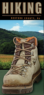
Home » Things To Do » Outdoors » Hiking
This is a gentle sloping loop trail with little gradient change.
It is Ideal for the Whole family and even for cross-country skiing.
Area: Blue Knob Area
Distance: 2.5 Miles
Difficulty: Moderate
Loops? Yes
Easy hike through the forest. Not quite as flat and easy as the Lake Shore Trail, but still fine for most children. If you want a longer hike, combine with Shawnee’s Field Trail.
Area: Shawnee Area
Distance: 2 Miles
Difficulty: Easy
Loops? yes
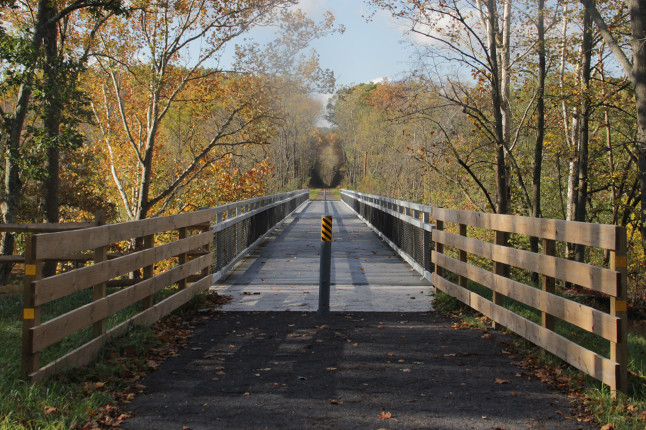
The new Huntingdon and Broad Top Rail Trail, which reuses a former railroad right-of-way to provide public recreational along the Raystown Branch of the Juniata River, is now complete! The H&BT Rail Trail is open to hikers and bikers with 10.6 miles of trail open between Riddlesburg at the north end and Tatesville at the south.
Trailhead Locations:
A beautiful trail, most of it on pea gravel. Fine for biking and you can push a stroller on most parts of the trail! Picnic tables. Little elevation change. Practically a sidewalk!
Area: Shawnee Area
Distance: 3.4 Miles
Difficulty: Easy
Loops? Yes
The highest knob, the sharpest ridgelines, and some of the most dramatic views on Mid State Trail await intrepid hikers in the Everett Region. Everett Region starts at a connection with trails of Green Ridge State Forest at the Maryland line, climbs the highest and wildest sections of Tussey Ridge, and ends at US 22 near Water Street.
Area: Mid-State
Distance: 323 Miles
Difficulty: Difficult
Loops? No
2,000 to 3,000+ feet elevation. Avoid during inclement weather due to chance of dense fog. Beautiful views. Not suitable for young children.
Area: Blue Knob Area
Distance: 5 Miles
Difficulty: Difficult
Loops? Yes
1,500 to 2,300 feet. Steady uphill climb…then steady descent. This ridge and valley trail is suitable for families with older children.
Area: Blue Knob Area
Distance: 2.8 Miles
Difficulty: Moderate
Loops? Yes
More trails than you can walk in one visit!
If you are planning a trip to Bedford County, give us a call today for your free copy of the Hiking Bedford County brochure.
The new Huntingdon and Broad Top Rail Trail, which reuses a former railroad right-of-way to provide public recreational access along the Raystown Branch of the Juniata River, is now open. The H&BT Rail Trail is open to hikers and bikers with 10 miles of trail open between Riddlesburg and Tatesville.
Trailhead Locations:
Riddlesburg Park Trailhead Hopewell Trailhead
Cooper Park Trailhead Cypher Bridge Trailhead
You can also walk on a former 10 mile section of the PA Turnpike complete with two tunnels. The Pike to Bike trail can be accessed from a pull-off just east of Breezewood at Rt. 30 and Tannery Road. Headlights are a must. Ride at your own risk. Map
For a safe and easy route between the town of Bedford and the Bedford Springs Hotel, we recommend the Bedford Heritage Trail. To access this trail, head south on Richard Street in Bedford to the end of the sidewalk. The newly completed Heritage Trail picks up there and continues about 2 miles south to the Bedford Springs Hotel.
Bedford County is in South Central PA along the PA Turnpike, Route 30 (Lincoln Highway), I-99 and I70.